Print
Department of Commerce
Published on Department of Commerce (https://2014-2017.commerce.gov)

Home > NOAA Provides Environmental Intelligence to Keep Goods Moving Along Our Marine Highways

You are here

  1. Home

NOAA Provides Environmental Intelligence to Keep Goods Moving Along Our Marine Highways

May142014

Print this page
Image(s) included
Post a comment
EnvironmentPhysical Oceanographic Real-time System

Posted at 10:58 AM

NOAA Provides Environmental Intelligence to Keep Goods Moving Along Our Marine Highways

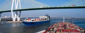
By weight, 75 percent of U.S. international trade moves through the nation’s ports and harbors. Those ports support, directly and indirectly, more than 13 million American jobs.

NOAA provides environmental intelligence to support safe, efficient, and environmentally sound navigation through U.S. ports. NOAA produces the nation’s nautical charts, which provide essential navigation information such as water depths; locations of dangers to navigation; locations and characteristics of aids to navigation; anchorages; and other features.

NOAA also integrates ocean and coastal observations, data, science, and services to provide actionable information, thereby improving informed choices. Good decisions today protect lives and property tomorrow.

The agency monitors, assesses, and distributes tide, current, and water level products and services. Positioning information from NOAA provides a highly accurate, precise, and consistent framework to help mariners safely navigate around obstructions in our nation's busy waterways.

NOAA’s role warning coastal areas of hurricane threats is well known, but the agency also plays a significant role after the storm. NOAA moves quickly to help reopen ports. Navigation response teams survey ports and channels, searching for submerged debris and other dangers to navigation. NOAA aerial photography helps the public, decision makers, and insurance adjusters assess the extent of storm damage.

In addition, NOAA's Physical Oceanographic Real-time System (PORTS®) provides accurate real-time oceanographic information, tailored to the specific needs of local maritime communities. Knowledge of the currents, water levels, winds, and density of the water can increase the amount of cargo moved through a port and harbor by enabling mariners to safely utilize every inch of dredged channel depth. For example, an economic study showed that the Tampa Bay economy receives more than $7 million a year in savings and direct income from PORTS®. A second study calculated $16 million a year in savings for the Houston-Galveston region.

Learn more at http://oceanservice.noaa.gov/navigation/marinenav/

Organizations and Groups

  • National Oceanic and Atmospheric Administration
  • National Ocean Service

Related content

May152015

ports-infographic.jpg

Graph of Physical Oceanographic Real-Time System (PORTS®)
Image(s) included
Post a comment

World Trade Month: NOAA Welcomes Two New Seaports as Part of the Physical Oceanographic Real-Time System (PORTS®)

Trade and InvestmentEnvironmentPhysical Oceanographic Real-time System
Two southeast Louisiana shipping hubs, critical to the U.S. economy, are now part of NOAA's Physical Oceanographic Real Time System (PORTS®). The new multi-sensor...

Jul232014

dames_point_ag_2_april_2011_otechusa.jpg

NOAA and Partners Provide Real-time Information to Keep Economic Activity Flowing in Port of Jacksonville
Image(s) included
Post a comment

NOAA and Partners Provide Real-time Information to Keep Economic Activity Flowing in Port of Jacksonville

DataEnvironmentPhysical Oceanographic Real-time System
Our country’s port system is an essential driver of the U.S. economy and for connecting us to the rest of the world. Every day, U.S. ports and waterways handle millions of...
/*Fix video embed transcript line height which was set to 0, squishing transcript to one line.*/ .file.view-mode-embedded_video { line-height: inherit; }

Source URL: https://2014-2017.commerce.gov/news/blog/2014/05/noaa-provides-environmental-intelligence-keep-goods-moving-along-our-marine

Links:
[1] https://2014-2017.commerce.gov/news/blog/2014/05/noaa-provides-environmental-intelligence-keep-goods-moving-along-our-marine
[2] https://2014-2017.commerce.gov/node/477#comment-form-collapsed
[3] https://2014-2017.commerce.gov/categories/environment
[4] https://2014-2017.commerce.gov/tags/physical-oceanographic-real-time-system
[5] https://2014-2017.commerce.gov/media/photo/noaashipjpg
[6] http://tidesandcurrents.noaa.gov/publications/Estimated_Economic_Benefits_from_NOAA_PORTS_report.pdf
[7] http://tidesandcurrents.noaa.gov/publications/EstimatingEconomicBenefitsfromNOAAPORTSInformation_Houston-Galveston.pdf
[8] http://oceanservice.noaa.gov/navigation/marinenav/